Completing the Wasatch Ultimate Ridge Linkup
While this blog does an alright job of conveying some of the emotions and struggles encountered during this objective, however, I would highly encourage you to check out the video at the bottom of this page does a great job of showing what it was really like. Thanks for taking the time to read this! JM @mistafabrizi

The Wasatch Ultimate Ridge Linkup is a route that circumnavigates Little Cottonwood Canyon, an iconic playground of mountains, valleys, ridges, lakes and ski resorts that sits just above our home town of Salt Lake City Utah. The route is 32 - 36 miles (depending on how well you nail it) and involves almost 20k feet of vertical elevation gain.

The W.U.R.L has been a goal of mine to complete for the last 5 years. Over this past weekend, after a summer of thinking, dreaming and hoping that I could finish it, I decided to give it a shot.
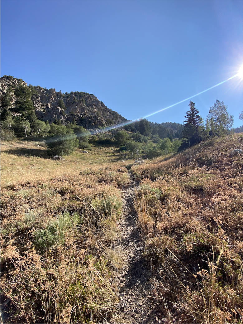
Starting at 9 am on Friday, I began the ascent up Ferguson Canyon towards Twin peaks. Shortly after hitting the first few summits, I ran out of water which made for a grueling push to Cardiff pass (where my first resupply awaited me). I have never been so excited to drink water in my life. After tanking back up, I pressed on, slowly checking off mile after mile, hitting resupply number 2 and 3 at Snowbird shortly before sunset.
At this point, I was moving faster that expected… but this also meant that I was going into downright gnarly and unfamiliar territory as I pushed on into the night. Forgetting to dump electrolytes into my bladder at Snowbird didn’t help either and after sucking down almost a gallon of “regular” water in-between Snowbird and the Red-pine intersection, I was feeling absolutely nauseated and over it by the time I hit my 4th and final resupply.

I made a call to my girlfriend and complained about how I was feeling. Waah Waah. She motivated me big time, I forced myself to eat - bananas, cliff bars, fig newtons (foods that at this point I had become all too familiar with) and couldn’t help but wonder how long it would be until I was sitting in a nice comfy car down in the valley. Quitting was not an option. Coke! I have a can of Coke! Drink that, it will make you feel better. Boom, I started to come back to life and the cold temps helped me get moving again as it was either that or continue to shiver in the dark to the glow of my headlamp which at this point was on the low setting as I was trying to conserve battery.

Smiling makes you feel better… Right?!
Moving forward, Phifferhorn —> Big Horn was a straight up blur other than the fact that clouds seemed to be quickly approaching from the east, which kept me on my toes, not to mention the beautiful lightning display that I was lucky enough to bare witness to (and thankfully stay out of) that was happening down in the Valley.
FINALLY, Big Horn. I knew that this was going to be (one of) the cruxes of this mission as I had heard that it was brutal, but honestly didn’t think that it would be as bad as I soon found out it was. Not knowing the route, making downright questionable moves through pitch black I skirted through the summit. I saw headlamps… a beacon!! I had to catch them.
Shortly prior to the last (lone peak) aptly named, I came across two super nice dudes. Didn’t get their names, but their stoke and positive vibes fueled me to continue pushing on. DUDE YOU ARE CRUSHING KEEP GOING!!
After another half hour, I was at the top of the notch - one final brutal decent down the chute into Bells Canyon. Where I knew at the bottom there was an actual trail waiting for me. One step at a time, pieced my way down that thing and made it to the lake. Had it not been for my watch constantly reminding me, I think that all perception of time would have been lost at this point. THE TRAIL, YES!!!
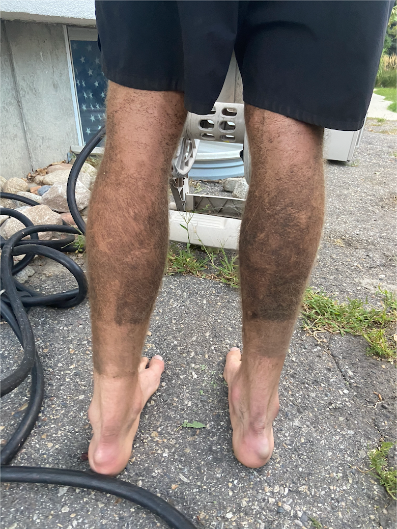
Coasting for a mile or 2, then… SHIT! Where is it?! 2+ miles of bushwhacking, phone falls out of pocket in bushes… NO…. This can't be. By some straight up miracle I find it, and make it back to the trail.
What seemed like an eternity of running / jogging to the continuous chant of “don’t mess up now, don’t blow it, you are almost there”, the trail starts to flatten as I near the bottom and the sun is now just starting to come up.
21 hours 25 minutes and 31 seconds later, I am back down in the valley.
I am absolutely ecstatic, although I have no energy to show it and can not believe it is over. In the days since, I have been feeling so incredibly lucky and fortunate to have even been able to have attempted this thing and overwhelmed by the congratulations and kind words that people have shared since finishing.
I owe a massive thanks to all of those that helped me accomplish this goal and provided guidance and support along the way. I think that it is also important to thank Jared Campbell for dreaming this up and for all of the beta and inspiration that his blog has provided me with over the years.
Much love, thanks for reading.
JM